
Prodromos topographic map
Interactive map
Click on the map to display elevation.
About this map
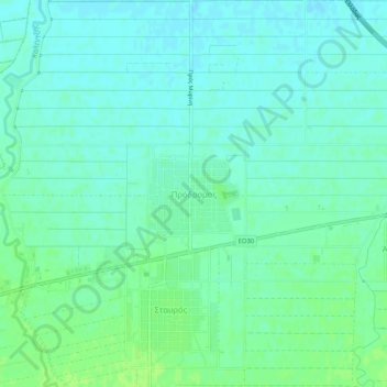
Name: Prodromos topographic map, elevation, terrain.
Average elevation: 101 m
Minimum elevation: 96 m
Maximum elevation: 108 m
Other topographic maps
Click on a map to view its topography, its elevation and its terrain.
Karditsa
Griechenland > Thessalien - Mittelgriechenland > Regionalbezirk Karditsa
Karditsa, Δήμος Καρδίτσας, Regionalbezirk Karditsa, Region Thessalien, Thessalien - Mittelgriechenland, 431 00, Griechenland
Average elevation: 223 m