
龙山镇 topographic map
Interactive map
Click on the map to display elevation.
About this map
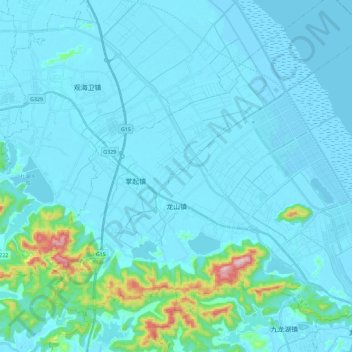
Name: 龙山镇 topographic map, elevation, terrain.
Location: 龙山镇, 慈溪市, 宁波市, 浙江省, 中国 (30.04067 121.44463 30.20257 121.67361)
Average elevation: 35 m
Minimum elevation: -1 m
Maximum elevation: 416 m
Other topographic maps
Click on a map to view its topography, its elevation and its terrain.