
Thank you for supporting this site ❤️
Make a donation
Make a donation
Helmand Province topographic map
Click on the map to display elevation.
Thank you for supporting this site ❤️
Make a donation
Make a donation
About this map
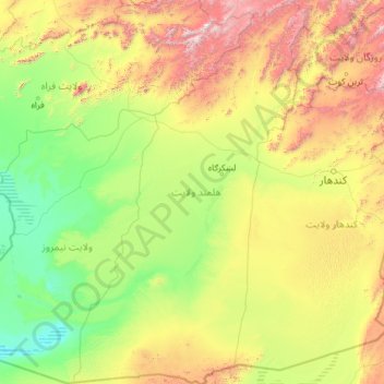
Name: Helmand Province topographic map, elevation, terrain.
Location: Helmand Province, Afghanistan (29.37729 62.55310 33.36983 65.37155)
Average elevation: 1,089 m
Minimum elevation: 452 m
Maximum elevation: 3,981 m
Thank you for supporting this site ❤️
Make a donation
Make a donation
Other topographic maps
Click on a map to view its topography, its elevation and its terrain.