
盘江乡 topographic map
Interactive map
Click on the map to display elevation.
About this map
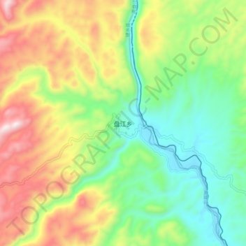
Name: 盘江乡 topographic map, elevation, terrain.
Location: 盘江乡, 建水县, 红河哈尼族彝族自治州, 云南省, 中国 (23.97952 103.08498 24.05952 103.16498)
Average elevation: 1,390 m
Minimum elevation: 1,084 m
Maximum elevation: 1,862 m
Other topographic maps
Click on a map to view its topography, its elevation and its terrain.