
巡检司镇 topographic map
Interactive map
Click on the map to display elevation.
About this map
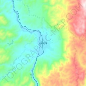
Name: 巡检司镇 topographic map, elevation, terrain.
Location: 巡检司镇, 弥勒市, 红河哈尼族彝族自治州, 云南省, 中国 (23.92231 103.14453 24.00231 103.22453)
Average elevation: 1,332 m
Minimum elevation: 1,076 m
Maximum elevation: 1,830 m
Other topographic maps
Click on a map to view its topography, its elevation and its terrain.