
Gladewater Park topographic map
Interactive map
Click on the map to display elevation.
About this map
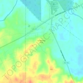
Name: Gladewater Park topographic map, elevation, terrain.
Location: Gladewater Park, Gregg County, Texas, 75647, United States (32.49153 -94.99716 32.53153 -94.95716)
Average elevation: 98 m
Minimum elevation: 78 m
Maximum elevation: 137 m
Other topographic maps
Click on a map to view its topography, its elevation and its terrain.
Easton
United States > Texas > Gregg County
Easton, Gregg County, Texas, 75641, United States
Average elevation: 85 m
Longview
United States > Texas > Gregg County
Longview, Gregg County, Texas, United States
Average elevation: 105 m