
Río Puela topographic map
Interactive map
Click on the map to display elevation.
About this map
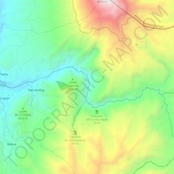
Name: Río Puela topographic map, elevation, terrain.
Location: Río Puela, El Altar, Penipe, Chimborazo, Ecuador (-1.53494 -78.51837 -1.51018 -78.41340)
Average elevation: 3,245 m
Minimum elevation: 2,329 m
Maximum elevation: 4,995 m
Other topographic maps
Click on a map to view its topography, its elevation and its terrain.
Río Naranjal
Ecuador > Chimborazo > Penipe > El Altar
Río Naranjal, El Altar, Penipe, Chimborazo, Ecuador
Average elevation: 3,251 m