
Río Naranjal topographic map
Interactive map
Click on the map to display elevation.
About this map
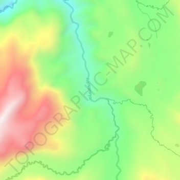
Name: Río Naranjal topographic map, elevation, terrain.
Location: Río Naranjal, El Altar, Penipe, Chimborazo, Ecuador (-1.57196 -78.41340 -1.52710 -78.39918)
Average elevation: 3,251 m
Minimum elevation: 2,876 m
Maximum elevation: 3,753 m
Other topographic maps
Click on a map to view its topography, its elevation and its terrain.
Río Puela
Ecuador > Chimborazo > Penipe > El Altar
Río Puela, El Altar, Penipe, Chimborazo, Ecuador
Average elevation: 3,245 m