Geolocate

Consuelo topographic map

Interactive map

Click on the map to display elevation.

About this map

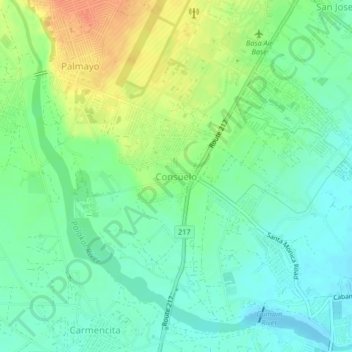
Name: Consuelo topographic map, elevation, terrain.

Location: Consuelo, Pampanga, Central Luzon, 2006, Philippines (14.94534 120.47356 14.98534 120.51356)

Average elevation: 31 m

Minimum elevation: 15 m

Maximum elevation: 56 m

Other topographic maps

Click on a map to view its topography, its elevation and its terrain.

Paligui

Philippines > Pampanga > Apalit

Average elevation: 3 m

Candaba

Philippines > Pampanga

Average elevation: 24 m

San Agustin

Philippines > Pampanga > San Fernando

Average elevation: 15 m

Calulut

Philippines > Pampanga > San Fernando

Average elevation: 40 m

Sta. Rita EcoPark

Philippines > Pampanga > San Isidro

Average elevation: 21 m

Camias

Philippines > Pampanga

Average elevation: 252 m

San Fernando

Philippines > Pampanga > San Fernando

Average elevation: 24 m