
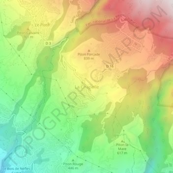
La Chapelle topographic map
Interactive map
Click on the map to display elevation.
About this map
Name: La Chapelle topographic map, elevation, terrain.
Average elevation: 641 m
Minimum elevation: 145 m
Maximum elevation: 1,227 m
Other topographic maps
Click on a map to view its topography, its elevation and its terrain.
Le Tevelave
France > La Réunion > Les Avirons > La Chapelle
Le Tevelave, La Chapelle, Les Avirons, Saint-Pierre, La Réunion, 97425, France
Average elevation: 890 m
Bras de la Ravine Sèche
France > La Réunion > Les Avirons
Bras de la Ravine Sèche, Les Avirons, Saint-Pierre, La Réunion, 97425, France
Average elevation: 1,592 m
Le Bois de Nèfles Cadet
France > La Réunion > Les Avirons
Le Bois de Nèfles Cadet, Les Avirons, Saint-Pierre, La Réunion, 97425, France
Average elevation: 221 m