
Thank you for supporting this site ❤️
Make a donation
Make a donation
Level Cross topographic map
Click on the map to display elevation.
Thank you for supporting this site ❤️
Make a donation
Make a donation
About this map
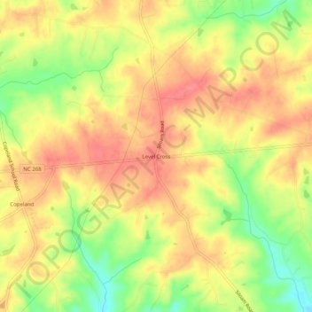
Name: Level Cross topographic map, elevation, terrain.
Location: Level Cross, Surry County, North Carolina, United States (36.32458 -80.64867 36.36458 -80.60867)
Average elevation: 345 m
Minimum elevation: 302 m
Maximum elevation: 371 m
Thank you for supporting this site ❤️
Make a donation
Make a donation
Other topographic maps
Click on a map to view its topography, its elevation and its terrain.