
望乡 topographic map
Interactive map
Click on the map to display elevation.
About this map
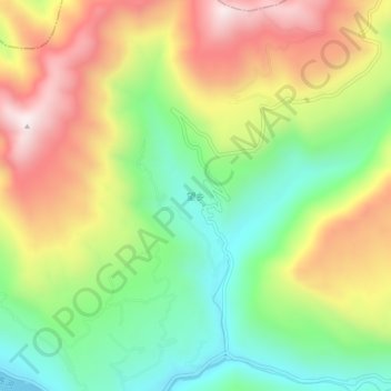
Name: 望乡 topographic map, elevation, terrain.
Location: 望乡, 苍溪县, 广元市, 四川省, 中国 (32.07287 106.23837 32.11287 106.27837)
Average elevation: 775 m
Minimum elevation: 425 m
Maximum elevation: 1,211 m
Other topographic maps
Click on a map to view its topography, its elevation and its terrain.