
East Kazakhstan Region topographic map
Interactive map
Click on the map to display elevation.
About this map
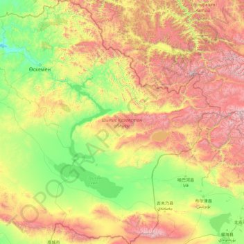
Name: East Kazakhstan Region topographic map, elevation, terrain.
Location: East Kazakhstan Region, Kazakhstan (46.86285 81.13772 51.01504 87.31563)
Average elevation: 1,182 m
Minimum elevation: 241 m
Maximum elevation: 4,350 m
Other topographic maps
Click on a map to view its topography, its elevation and its terrain.