
Thank you for supporting this site ❤️
Make a donation
Make a donation
Almaty topographic map
Click on the map to display elevation.
Thank you for supporting this site ❤️
Make a donation
Make a donation
About this map
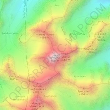
Name: Almaty topographic map, elevation, terrain.
Location: Almaty, Talgar District, Almaty Region, Kazakhstan (43.08649 77.12022 43.08659 77.12032)
Average elevation: 3,768 m
Minimum elevation: 3,294 m
Maximum elevation: 4,319 m
Thank you for supporting this site ❤️
Make a donation
Make a donation