
Richat Structure topographic map
Interactive map
Click on the map to display elevation.
About this map
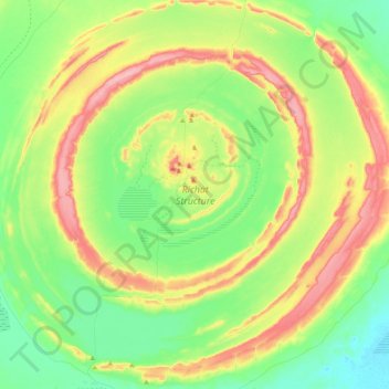
Name: Richat Structure topographic map, elevation, terrain.
Location: Richat Structure, Adrar, Mauritania (21.01565 -11.49839 21.20586 -11.29103)
Average elevation: 411 m
Minimum elevation: 358 m
Maximum elevation: 491 m
Other topographic maps
Click on a map to view its topography, its elevation and its terrain.