
新化县 topographic map
Interactive map
Click on the map to display elevation.
About this map
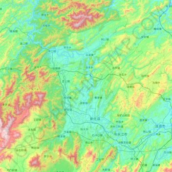
Name: 新化县 topographic map, elevation, terrain.
Location: 新化县, 娄底市, 湖南省, 中国 (27.52135 110.76281 28.23490 111.65620)
Average elevation: 459 m
Minimum elevation: 135 m
Maximum elevation: 1,584 m
Other topographic maps
Click on a map to view its topography, its elevation and its terrain.