
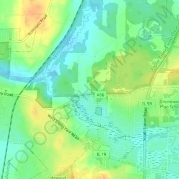
Schaumburg Road Grasslands topographic map
Interactive map
Click on the map to display elevation.
About this map
Name: Schaumburg Road Grasslands topographic map, elevation, terrain.
Average elevation: 246 m
Minimum elevation: 232 m
Maximum elevation: 265 m
Other topographic maps
Click on a map to view its topography, its elevation and its terrain.
Chicago
United States > Illinois > Cook County
Chicago, Cook County, Illinois, United States
Average elevation: 182 m
Elk Grove Township
United States > Illinois > Cook County
Elk Grove Township, Cook County, Illinois, United States
Average elevation: 211 m
Summit
United States > Illinois > Cook County
Summit, Lyons Township, Cook County, Illinois, 60501, United States
Average elevation: 186 m
Lemont
United States > Illinois > Cook County
Lemont, Lemont Township, Cook County, Illinois, 60439, United States
Average elevation: 209 m
Palos Heights
United States > Illinois > Cook County
Palos Heights, Worth Township, Cook County, Illinois, 60463, United States
Average elevation: 193 m
Bessemer Park
United States > Illinois > Cook County > Chicago
Bessemer Park, 8930, South Chicago, Chicago, Hyde Park Township, Cook County, Illinois, 60617, United States
Average elevation: 180 m
Palos Hills
United States > Illinois > Cook County
Palos Hills, Palos Township, Cook County, Illinois, 60465, United States
Average elevation: 187 m
Hamilton Park
United States > Illinois > Cook County > Chicago
Hamilton Park, Englewood, Chicago, Lake Township, Cook County, Illinois, 60621, United States
Average elevation: 183 m
Maple Lake
United States > Illinois > Cook County
Maple Lake, Palos Township, Cook County, Illinois, United States
Average elevation: 203 m
Oak Forest
United States > Illinois > Cook County
Oak Forest, Bremen Township, Cook County, Illinois, 60452, United States
Average elevation: 203 m
Hoffman Estates
United States > Illinois > Cook County
Hoffman Estates, Schaumburg Township, Cook County, Illinois, United States
Average elevation: 239 m
Bartlett
United States > Illinois > Cook County
Bartlett, Hanover Township, Cook County, Illinois, 60103, United States
Average elevation: 242 m
Forest Park
United States > Illinois > Cook County
Forest Park, Proviso Township, Cook County, Illinois, 60130, United States
Average elevation: 191 m
Henry C. Palmisano Park
United States > Illinois > Cook County > Chicago
Henry C. Palmisano Park, Bridgeport, Chicago, Cook County, Illinois, United States
Average elevation: 182 m
1st Ward, Chicago
United States > Illinois > Cook County > Chicago
1st Ward, Chicago, Chicago, Jefferson Township, Cook County, Illinois, 60647, United States
Average elevation: 183 m
Tinley Park
United States > Illinois > Cook County
Tinley Park, Bremen Township, Cook County, Illinois, United States
Average elevation: 214 m
Hyde Park
United States > Illinois > Cook County > Chicago
Hyde Park, Chicago, Hyde Park Township, Cook County, Illinois, United States
Average elevation: 182 m
Stockham Park
United States > Illinois > Cook County > Evanston
Stockham Park, South Evanston, Evanston, Evanston Township, Cook County, Illinois, United States
Average elevation: 181 m
McCook
United States > Illinois > Cook County > McCook
McCook, Lyons Township, Cook County, Illinois, United States
Average elevation: 184 m
Cicero
United States > Illinois > Cook County > Cicero
Cicero, Cook County, Illinois, 60804, United States
Average elevation: 185 m
Oak Park
United States > Illinois > Cook County
Oak Park, Cook County, Illinois, United States
Average elevation: 192 m
Chicago, North Shore & Milwaukee
United States > Illinois > Cook County > Northbrook > Williamsburg Square
Chicago, North Shore & Milwaukee, Edens Spur, Williamsburg Square, Northbrook, Northfield Township, Cook County, Illinois, 60015-1331, United States
Average elevation: 198 m
Glencoe
United States > Illinois > Cook County
Glencoe, New Trier Township, Cook County, Illinois, 60022, United States
Average elevation: 194 m
Columbia Basin
United States > Illinois > Cook County > Chicago
Columbia Basin, Hyde Park, Chicago, Hyde Park Township, Cook County, Illinois, United States
Average elevation: 180 m
Park Ridge
United States > Illinois > Cook County > Park Ridge
Park Ridge, Maine Township, Cook County, Illinois, 60068, United States
Average elevation: 198 m
West Branch Du Page River
United States > Illinois > Cook County > Schaumburg
West Branch Du Page River, Weathersfield, Schaumburg, Schaumburg Township, Cook County, Illinois, 60193, United States
Average elevation: 249 m
Duxbury Park
United States > Illinois > Cook County > Schaumburg
Duxbury Park, Weathersfield, Schaumburg, Schaumburg Township, Cook County, Illinois, United States
Average elevation: 249 m
Camberly Park
United States > Illinois > Cook County > Westchester
Camberly Park, Westchester, Proviso Township, Cook County, Illinois, United States
Average elevation: 202 m
Elmwood Park
United States > Illinois > Cook County > Elmwood Park > Elmwood Park
Elmwood Park, Leyden Township, Cook County, Illinois, 60707, United States
Average elevation: 194 m
Albany Park
United States > Illinois > Cook County > Chicago
Albany Park, Chicago, Jefferson Township, Cook County, Illinois, 60625, United States
Average elevation: 184 m
Lansing
United States > Illinois > Cook County > Lansing
Lansing, Thornton Township, Cook County, Illinois, 60438, United States
Average elevation: 186 m
Franklin Park
United States > Illinois > Cook County
Franklin Park, Leyden Township, Cook County, Illinois, United States
Average elevation: 196 m
Evanston
United States > Illinois > Cook County
Evanston, Evanston Township, Cook County, Illinois, United States
Average elevation: 184 m
Palatine
United States > Illinois > Cook County
Palatine, Palatine Township, Cook County, Illinois, United States
Average elevation: 229 m
Pullman
United States > Illinois > Cook County > Chicago
Pullman, Chicago, Hyde Park Township, Cook County, Illinois, United States
Average elevation: 183 m
Crestwood
United States > Illinois > Cook County > Crestwood
Crestwood, Worth Township, Cook County, Illinois, United States
Average elevation: 190 m
River Forest
United States > Illinois > Cook County > River Forest
River Forest, Cook County, Illinois, 60305, United States
Average elevation: 194 m
Orland Park
United States > Illinois > Cook County
Orland Park, Orland Township, Cook County, Illinois, 60462, United States
Average elevation: 216 m
Stickney
United States > Illinois > Cook County
Stickney, Stickney Township, Cook County, Illinois, United States
Average elevation: 184 m
Schaumburg
United States > Illinois > Cook County
Schaumburg, Schaumburg Township, Cook County, Illinois, United States
Average elevation: 237 m
Elmwood Park
United States > Illinois > Cook County
Elmwood Park, Leyden Township, Cook County, Illinois, United States
Average elevation: 195 m
Blue Island
United States > Illinois > Cook County
Blue Island, Calumet Township, Cook County, Illinois, 60406, United States
Average elevation: 186 m
Kenilworth
United States > Illinois > Cook County
Kenilworth, New Trier Township, Cook County, Illinois, United States
Average elevation: 188 m
Burnham
United States > Illinois > Cook County
Burnham, Thornton Township, Cook County, Illinois, United States
Average elevation: 180 m
Waterton Park
United States > Illinois > Cook County > Streamwood
Waterton Park, Surrey Woods, Streamwood, Hanover Township, Cook County, Illinois, United States
Average elevation: 247 m
Berwyn
United States > Illinois > Cook County
Berwyn, Cook County, Illinois, 60402, United States
Average elevation: 188 m
Mount Prospect
United States > Illinois > Cook County > Mount Prospect
Mount Prospect, Wheeling Township, Cook County, Illinois, United States
Average elevation: 205 m
Skokie
United States > Illinois > Cook County
Skokie, Niles Township, Cook County, Illinois, United States
Average elevation: 188 m
Dolton
United States > Illinois > Cook County
Dolton, Thornton Township, Cook County, Illinois, 60419, United States
Average elevation: 183 m
Barrington
United States > Illinois > Cook County
Barrington, Barrington Township, Cook County, Illinois, 60010, United States
Average elevation: 257 m