

Make a donation
Illinois topographic maps
Click on a map to view its topography, its elevation and its terrain.


Make a donation
Champaign County
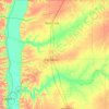
The topography of Champaign County was formed by the Wisconsin Glacier about 20,000 years before the present. Lobes of ice from what is now Lake Michigan crossed the county, creating a deep pile of glacial soil, up to 300 feet thick, topped by numerous moraines forming small, flat watersheds with no outlets.
Average elevation: 217 m

Make a donation

Make a donation

Make a donation



Make a donation

Make a donation
Make a donation



Make a donation

Make a donation
Make a donation
Make a donation
Make a donation

Make a donation



Make a donation
Rock Cut State Park
United States > Illinois > Winnebago County > Machesney Park
Average elevation: 265 m


Make a donation

Make a donation


Make a donation
Make a donation


Make a donation

Berwyn
United States > Illinois > Cook County
According to the 2021 census gazetteer files, Berwyn has a total area of 3.90 square miles (10.10 km2), all land. Bordering cities include Oak Park to the north, Cicero to the east, Stickney to the south, Lyons, Riverside, North Riverside, and Forest Park to the west. Geologically, Berwyn is predominately…
Average elevation: 188 m
Make a donation
Make a donation
Wilmette
United States > Illinois > Cook County
Between 1900 and 1920 the village saw its population more than triple to 7,814. In 1922 the village adopted the "Plan of Wilmette", which outlined a vision for its future that included open spaces along Green Bay Road and the elevation of the railroad tracks to provide unobstructed flow of traffic between the…
Average elevation: 186 m

Make a donation


Make a donation


Make a donation
Plainfield
United States > Illinois > Will County
Like its namesake, Plainfield's topography is generally flat. Thousands of years ago, land in greater Plainfield used to be part of the bed of proglacial Lake Wauponsee. However, the lake did not hold up long, and eventually drained into the Illinois River valley. The lake left behind a very flat landscape.…
Average elevation: 194 m

Make a donation