
Wuppertal topographic map
Interactive map
Click on the map to display elevation.
About this map
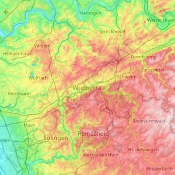
Name: Wuppertal topographic map, elevation, terrain.
Location: Wuppertal, Rhénanie-du-Nord-Westphalie, 42285, Allemagne (51.10402 7.01804 51.42402 7.33804)
Average elevation: 209 m
Minimum elevation: 40 m
Maximum elevation: 420 m
Other topographic maps
Click on a map to view its topography, its elevation and its terrain.
Gemarkung Elberfeld
Allemagne > Rhénanie-du-Nord-Westphalie > Wuppertal
Gemarkung Elberfeld, Wuppertal, Regierungsbezirk Düsseldorf, Rhénanie-du-Nord-Westphalie, Allemagne
Average elevation: 228 m