
Gemarkung Elberfeld topographic map
Interactive map
Click on the map to display elevation.
About this map
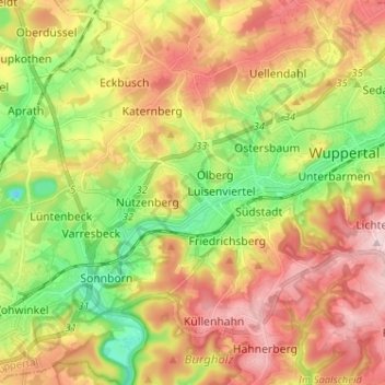
Name: Gemarkung Elberfeld topographic map, elevation, terrain.
Average elevation: 228 m
Minimum elevation: 105 m
Maximum elevation: 354 m
Other topographic maps
Click on a map to view its topography, its elevation and its terrain.
Wuppertal
Allemagne > Rhénanie-du-Nord-Westphalie > Wuppertal
Wuppertal, Rhénanie-du-Nord-Westphalie, 42285, Allemagne
Average elevation: 209 m