
Munglinup topographic map
Interactive map
Click on the map to display elevation.
About this map
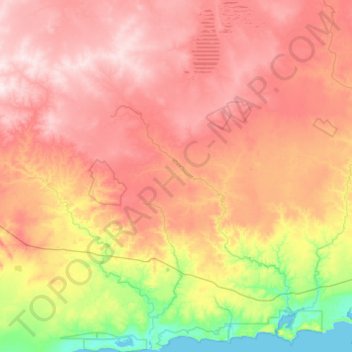
Name: Munglinup topographic map, elevation, terrain.
Location: Munglinup, Shire Of Ravensthorpe, 西澳大利亚州, 澳大利亚 (-33.89343 120.02752 -33.07899 120.87585)
Average elevation: 204 m
Minimum elevation: -1 m
Maximum elevation: 440 m
Other topographic maps
Click on a map to view its topography, its elevation and its terrain.
Mount Augustus
Mount Augustus, Shire Of Upper Gascoyne, 西澳大利亚州, 澳大利亚
Average elevation: 827 m
Wongan Hills
澳大利亚 > 西澳大利亚州 > Wongan Hills
Wongan Hills, Shire Of Wongan-ballidu, 西澳大利亚州, 6603, 澳大利亚
Average elevation: 295 m
Bonnie Rock
澳大利亚 > 西澳大利亚州 > Bonnie Rock
Bonnie Rock, Shire Of Mukinbudin, 西澳大利亚州, 澳大利亚
Average elevation: 429 m