
Loroñe topographic map
Interactive map
Click on the map to display elevation.
About this map
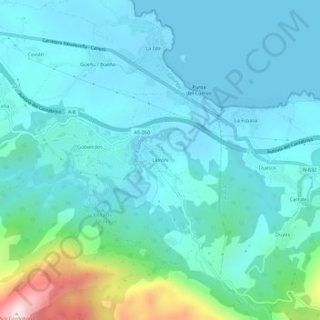
Name: Loroñe topographic map, elevation, terrain.
Location: Loroñe, Colunga, Asturias, 33342, España (43.44773 -5.24598 43.48773 -5.20598)
Average elevation: 107 m
Minimum elevation: 0 m
Maximum elevation: 678 m
Other topographic maps
Click on a map to view its topography, its elevation and its terrain.