
Thank you for supporting this site ❤️
Make a donation
Make a donation
Table Meadows topographic map
Click on the map to display elevation.
Thank you for supporting this site ❤️
Make a donation
Make a donation
About this map
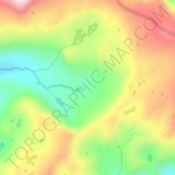
Name: Table Meadows topographic map, elevation, terrain.
Location: Table Meadows, Tulare County, California, United States (36.60829 -118.64589 36.62829 -118.62589)
Average elevation: 3,240 m
Minimum elevation: 3,029 m
Maximum elevation: 3,470 m
Thank you for supporting this site ❤️
Make a donation
Make a donation
Other topographic maps
Click on a map to view its topography, its elevation and its terrain.
Thank you for supporting this site ❤️
Make a donation
Make a donation
Thank you for supporting this site ❤️
Make a donation
Make a donation
Thank you for supporting this site ❤️
Make a donation
Make a donation