
Make a donation
Frog Meadow topographic map
Click on the map to display elevation.
Make a donation
About this map
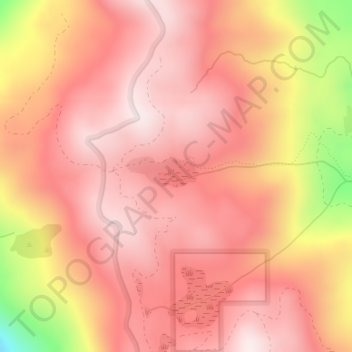
Name: Frog Meadow topographic map, elevation, terrain.
Location: Frog Meadow, Tulare County, California, United States (35.87183 -118.57663 35.87355 -118.57244)
Average elevation: 2,254 m
Minimum elevation: 1,859 m
Maximum elevation: 2,410 m
Make a donation
Other topographic maps
Click on a map to view its topography, its elevation and its terrain.
General Sherman Tree
United States > California > Tulare County
General Sherman is a giant sequoia (Sequoiadendron giganteum) tree located at an elevation of 2,109 m (6,919 ft) above sea level in the Giant Forest of Sequoia National Park in Tulare County, in the U.S. state of California. By volume, it is the largest known living single-stem tree on Earth.
Average elevation: 2,114 m
Make a donation
Make a donation
Make a donation
Make a donation
Porterville
United States > California > Tulare County > Porterville
Porterville, lying along the foothills of the Sierras at an elevation of 455 feet (139 m), is located on State Highway 65, 165 miles (266 km) north of Los Angeles, and 171 miles (275 km) east of the Pacific Coast. The city has a strategic central location to major markets and a ready access to major…
Average elevation: 222 m
Make a donation