
Bafi topographic map
Interactive map
Click on the map to display elevation.
About this map
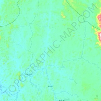
Name: Bafi topographic map, elevation, terrain.
Location: Bafi, Kono District, Eastern Province, Sierra Leone (8.66045 -11.25444 9.01114 -10.86001)
Average elevation: 413 m
Minimum elevation: 319 m
Maximum elevation: 1,256 m
Other topographic maps
Click on a map to view its topography, its elevation and its terrain.
Mobai
Sierra Leone > Eastern Province > Mobai
Mobai, Kailahun District, Eastern Province, Sierra Leone
Average elevation: 200 m
Bandama
Sierra Leone > Eastern Province > Bandama
Bandama, Kailahun District, Eastern Province, Sierra Leone
Average elevation: 360 m
Diame
Sierra Leone > Eastern Province > Diame
Diame, Kenema District, Eastern Province, Sierra Leone
Average elevation: 154 m