
益智乡 topographic map
Interactive map
Click on the map to display elevation.
About this map
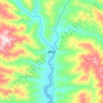
Name: 益智乡 topographic map, elevation, terrain.
Location: 益智乡, 景谷傣族彝族自治县, 普洱市, 云南省, 中国 (23.16908 100.55000 23.24908 100.63000)
Average elevation: 1,104 m
Minimum elevation: 786 m
Maximum elevation: 1,633 m
Other topographic maps
Click on a map to view its topography, its elevation and its terrain.