
正兴镇 topographic map
Interactive map
Click on the map to display elevation.
About this map
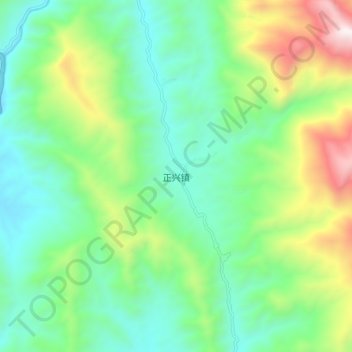
Name: 正兴镇 topographic map, elevation, terrain.
Location: 正兴镇, 景谷傣族彝族自治县, 普洱市, 云南省, 665000, 中国 (23.29220 100.92300 23.37220 101.00300)
Average elevation: 1,316 m
Minimum elevation: 931 m
Maximum elevation: 2,239 m
Other topographic maps
Click on a map to view its topography, its elevation and its terrain.