
Thank you for supporting this site ❤️
Make a donation
Make a donation
Daniel topographic map
Click on the map to display elevation.
Thank you for supporting this site ❤️
Make a donation
Make a donation
About this map
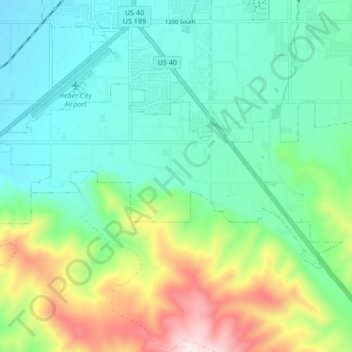
Name: Daniel topographic map, elevation, terrain.
Location: Daniel, Wasatch County, Utah, United States (40.44788 -111.44793 40.48148 -111.36381)
Average elevation: 1,868 m
Minimum elevation: 1,678 m
Maximum elevation: 2,364 m
Thank you for supporting this site ❤️
Make a donation
Make a donation
Other topographic maps
Click on a map to view its topography, its elevation and its terrain.