
Bancroft topographic map
Interactive map
Click on the map to display elevation.
About this map
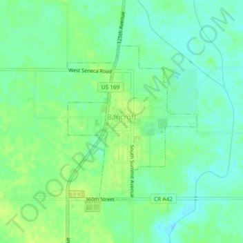
Name: Bancroft topographic map, elevation, terrain.
Location: Bancroft, Kossuth County, Iowa, United States (43.28389 -94.22649 43.30103 -94.20671)
Average elevation: 354 m
Minimum elevation: 346 m
Maximum elevation: 361 m
Other topographic maps
Click on a map to view its topography, its elevation and its terrain.
Lu Verne
United States > Iowa > Kossuth County
Lu Verne, Kossuth County, Iowa, United States
Average elevation: 351 m
Algona
United States > Iowa > Kossuth County
Algona, Kossuth County, Iowa, 50511, United States
Average elevation: 361 m
West Bend
United States > Iowa > Kossuth County > West Bend
West Bend, Kossuth County, Iowa, United States
Average elevation: 360 m