
Palampur topographic map
Interactive map
Click on the map to display elevation.
About this map
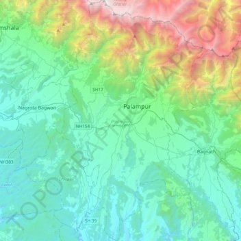
Name: Palampur topographic map, elevation, terrain.
Location: Palampur, Kangra, Himachal Pradesh, India (31.92933 76.40704 32.25170 76.64552)
Average elevation: 1,525 m
Minimum elevation: 604 m
Maximum elevation: 4,909 m
Other topographic maps
Click on a map to view its topography, its elevation and its terrain.