
Bolívar topographic map
Interactive map
Click on the map to display elevation.
About this map
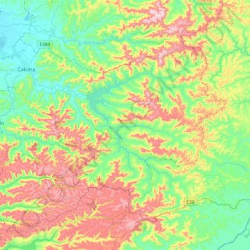
Name: Bolívar topographic map, elevation, terrain.
Location: Bolívar, Manabí, 130602, Équateur (-1.04937 -80.23712 -0.80999 -79.87222)
Average elevation: 203 m
Minimum elevation: 5 m
Maximum elevation: 552 m
Other topographic maps
Click on a map to view its topography, its elevation and its terrain.