
Pedernales topographic map
Interactive map
Click on the map to display elevation.
About this map
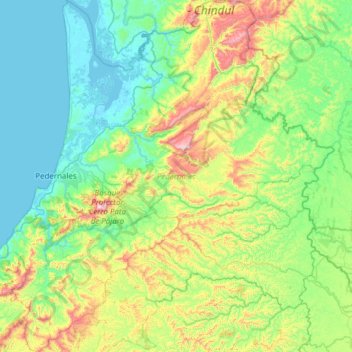
Name: Pedernales topographic map, elevation, terrain.
Location: Pedernales, Manabí, Équateur (-0.23766 -80.15948 0.37573 -79.56932)
Average elevation: 188 m
Minimum elevation: -4 m
Maximum elevation: 784 m
Other topographic maps
Click on a map to view its topography, its elevation and its terrain.