
姥山岛 topographic map
Interactive map
Click on the map to display elevation.
About this map
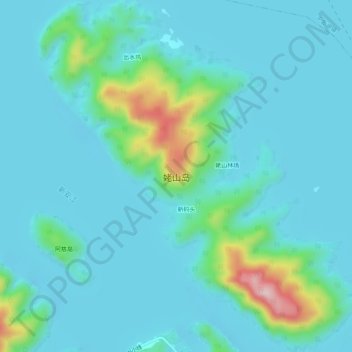
Name: 姥山岛 topographic map, elevation, terrain.
Location: 姥山岛, 淳安县, 杭州市, 浙江省, 中国 (29.51859 119.03950 29.56234 119.08573)
Average elevation: 137 m
Minimum elevation: 93 m
Maximum elevation: 382 m
Other topographic maps
Click on a map to view its topography, its elevation and its terrain.