
优干宁镇 topographic map
Interactive map
Click on the map to display elevation.
About this map
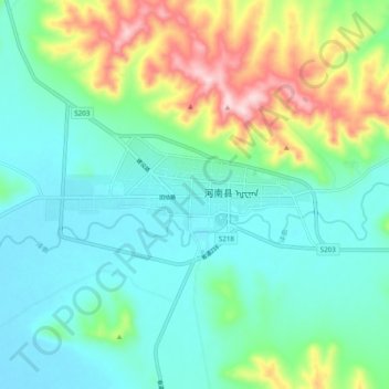
Name: 优干宁镇 topographic map, elevation, terrain.
Location: 优干宁镇, 河南蒙古族自治县, 黄南藏族自治州, 青海省, 811500, 中国 (34.69564 101.56528 34.77564 101.64528)
Average elevation: 3,585 m
Minimum elevation: 3,503 m
Maximum elevation: 3,814 m
Other topographic maps
Click on a map to view its topography, its elevation and its terrain.