
Naylor topographic map
Interactive map
Click on the map to display elevation.
About this map
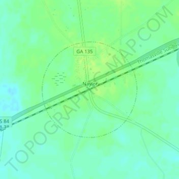
Name: Naylor topographic map, elevation, terrain.
Location: Naylor, Lowndes County, Georgia, United States (30.90070 -83.08665 30.91513 -83.06997)
Average elevation: 56 m
Minimum elevation: 50 m
Maximum elevation: 62 m
Other topographic maps
Click on a map to view its topography, its elevation and its terrain.
Valdosta
United States > Georgia > Lowndes County
Valdosta, Lowndes County, Georgia, United States
Average elevation: 58 m
Lake Park
United States > Georgia > Lowndes County
Lake Park, Lowndes County, Georgia, 31636, United States
Average elevation: 47 m
Valdosta
United States > Georgia > Lowndes County > Valdosta
Valdosta, Lowndes County, Georgia, 31604, United States
Average elevation: 54 m