
Lake Park topographic map
Interactive map
Click on the map to display elevation.
About this map
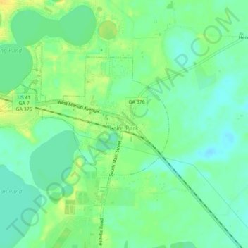
Name: Lake Park topographic map, elevation, terrain.
Location: Lake Park, Lowndes County, Georgia, 31636, United States (30.67117 -83.21553 30.69575 -83.17200)
Average elevation: 47 m
Minimum elevation: 37 m
Maximum elevation: 60 m
Other topographic maps
Click on a map to view its topography, its elevation and its terrain.
Valdosta
United States > Georgia > Lowndes County
Valdosta, Lowndes County, Georgia, United States
Average elevation: 58 m
Naylor
United States > Georgia > Lowndes County
Naylor, Lowndes County, Georgia, United States
Average elevation: 56 m
Valdosta
United States > Georgia > Lowndes County > Valdosta
Valdosta, Lowndes County, Georgia, 31604, United States
Average elevation: 54 m