
碓臼坪村 topographic map
Interactive map
Click on the map to display elevation.
About this map
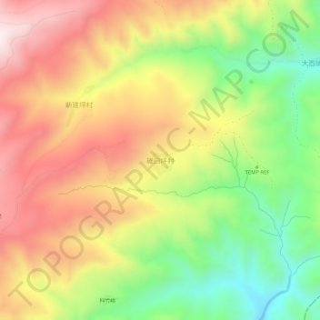
Name: 碓臼坪村 topographic map, elevation, terrain.
Location: 碓臼坪村, 应县, 朔州市, 山西省, 中国 (39.35574 113.46697 39.39574 113.50697)
Average elevation: 1,800 m
Minimum elevation: 1,482 m
Maximum elevation: 2,111 m
Other topographic maps
Click on a map to view its topography, its elevation and its terrain.