
Mufindi topographic map
Interactive map
Click on the map to display elevation.
About this map
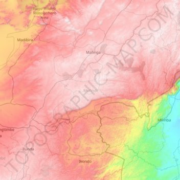
Name: Mufindi topographic map, elevation, terrain.
Location: Mufindi, Iringa, Southern Highlands Zone, Tanzanie (-9.04256 34.68399 -8.10144 35.98282)
Average elevation: 1,410 m
Minimum elevation: 273 m
Maximum elevation: 2,145 m
Other topographic maps
Click on a map to view its topography, its elevation and its terrain.