
El Houamed topographic map
Interactive map
Click on the map to display elevation.
About this map
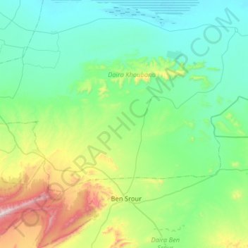
Name: El Houamed topographic map, elevation, terrain.
Location: El Houamed, Daïra Khoubana, M'Sila, Algérie (35.05240 4.24334 35.28168 4.76070)
Average elevation: 627 m
Minimum elevation: 389 m
Maximum elevation: 1,602 m
Other topographic maps
Click on a map to view its topography, its elevation and its terrain.
M'Cif
Algérie > M'Sila > Daïra Khoubana
M'Cif, Daïra Khoubana, M'Sila, Algérie
Average elevation: 436 m