
M'Cif topographic map
Interactive map
Click on the map to display elevation.
About this map
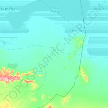
Name: M'Cif topographic map, elevation, terrain.
Location: M'Cif, Daïra Khoubana, M'Sila, Algérie (35.17947 4.55691 35.45110 4.88954)
Average elevation: 436 m
Minimum elevation: 384 m
Maximum elevation: 853 m
Other topographic maps
Click on a map to view its topography, its elevation and its terrain.
El Houamed
Algérie > M'Sila > Daïra Khoubana
El Houamed, Daïra Khoubana, M'Sila, Algérie
Average elevation: 627 m