
珠琳镇 topographic map
Interactive map
Click on the map to display elevation.
About this map
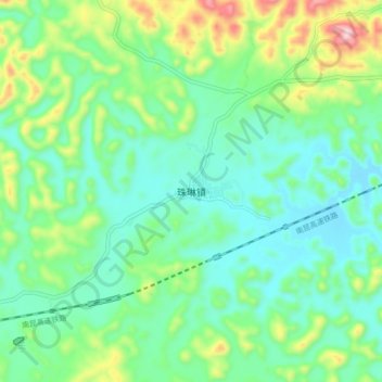
Name: 珠琳镇 topographic map, elevation, terrain.
Location: 珠琳镇, 广南县, 文山壮族苗族自治州, 云南省, 中国 (23.95319 104.61747 24.03319 104.69747)
Average elevation: 1,485 m
Minimum elevation: 1,381 m
Maximum elevation: 1,767 m
Other topographic maps
Click on a map to view its topography, its elevation and its terrain.