
板蚌乡 topographic map
Interactive map
Click on the map to display elevation.
About this map
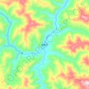
Name: 板蚌乡 topographic map, elevation, terrain.
Location: 板蚌乡, 广南县, 文山壮族苗族自治州, 云南省, 中国 (23.88010 105.43500 23.96010 105.51500)
Average elevation: 769 m
Minimum elevation: 469 m
Maximum elevation: 1,274 m
Other topographic maps
Click on a map to view its topography, its elevation and its terrain.