
Thank you for supporting this site ❤️
Make a donation
Make a donation
Sorens topographic map
Click on the map to display elevation.
Thank you for supporting this site ❤️
Make a donation
Make a donation
About this map
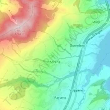
Name: Sorens topographic map, elevation, terrain.
Location: Sorens, Greyerzbezirk, Freiburg, 1642, Schweiz (46.65970 7.01244 46.68613 7.07747)
Average elevation: 854 m
Minimum elevation: 667 m
Maximum elevation: 1,208 m
Thank you for supporting this site ❤️
Make a donation
Make a donation
Other topographic maps
Click on a map to view its topography, its elevation and its terrain.