
Thank you for supporting this site ❤️
Make a donation
Make a donation
Longchamps topographic map
Click on the map to display elevation.
Thank you for supporting this site ❤️
Make a donation
Make a donation
About this map
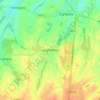
Name: Longchamps topographic map, elevation, terrain.
Location: Longchamps, Eghezée, Namur, Wallonie, 5310, Belgique (50.55729 4.87622 50.59729 4.91622)
Average elevation: 159 m
Minimum elevation: 139 m
Maximum elevation: 178 m
Thank you for supporting this site ❤️
Make a donation
Make a donation
Other topographic maps
Click on a map to view its topography, its elevation and its terrain.
Thank you for supporting this site ❤️
Make a donation
Make a donation
Thank you for supporting this site ❤️
Make a donation
Make a donation
Thank you for supporting this site ❤️
Make a donation
Make a donation