
Thank you for supporting this site ❤️
Make a donation
Make a donation
ST5 topographic map
Click on the map to display elevation.
Thank you for supporting this site ❤️
Make a donation
Make a donation
About this map
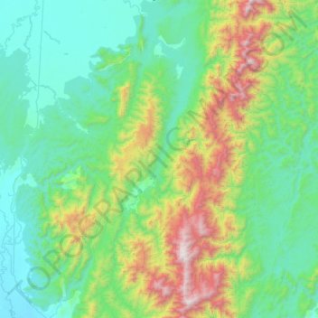
Name: ST5 topographic map, elevation, terrain.
Location: ST5, Kachin State, Myanmar (25.65717 96.88871 26.31475 97.06309)
Average elevation: 655 m
Minimum elevation: 160 m
Maximum elevation: 2,545 m
Thank you for supporting this site ❤️
Make a donation
Make a donation
Other topographic maps
Click on a map to view its topography, its elevation and its terrain.
Thank you for supporting this site ❤️
Make a donation
Make a donation
Thank you for supporting this site ❤️
Make a donation
Make a donation