
Thank you for supporting this site ❤️
Make a donation
Make a donation
Mansi Township topographic map
Click on the map to display elevation.
Thank you for supporting this site ❤️
Make a donation
Make a donation
About this map
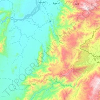
Name: Mansi Township topographic map, elevation, terrain.
Location: Mansi Township, Bhamo District, Kachin State, Myanmar (23.63325 96.97465 24.20398 97.75286)
Average elevation: 657 m
Minimum elevation: 87 m
Maximum elevation: 2,314 m
Thank you for supporting this site ❤️
Make a donation
Make a donation
Other topographic maps
Click on a map to view its topography, its elevation and its terrain.