
Settara topographic map
Interactive map
Click on the map to display elevation.
About this map
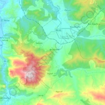
Name: Settara topographic map, elevation, terrain.
Location: Settara, Daïra Settara, Jijel, 18113, Algérie (36.65368 6.30265 36.75669 6.49052)
Average elevation: 316 m
Minimum elevation: 23 m
Maximum elevation: 1,157 m
Other topographic maps
Click on a map to view its topography, its elevation and its terrain.
Ghebala
Algérie > Jijel > Daïra Settara
Ghebala, Daïra Settara, Jijel, Algérie
Average elevation: 616 m