
Thank you for supporting this site ❤️
Make a donation
Make a donation
Two Lakes topographic map
Click on the map to display elevation.
Thank you for supporting this site ❤️
Make a donation
Make a donation
About this map
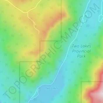
Name: Two Lakes topographic map, elevation, terrain.
Location: Two Lakes, Division No. 18, Alberta, Canada (54.34851 -119.78928 54.38451 -119.75162)
Average elevation: 1,255 m
Minimum elevation: 1,075 m
Maximum elevation: 1,678 m
Thank you for supporting this site ❤️
Make a donation
Make a donation
Other topographic maps
Click on a map to view its topography, its elevation and its terrain.