
俄支乡 topographic map
Interactive map
Click on the map to display elevation.
About this map
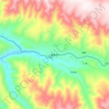
Name: 俄支乡 topographic map, elevation, terrain.
Location: 俄支乡, 德格县, 甘孜藏族自治州, 四川省, 中国 (32.28770 98.33429 32.36770 98.41429)
Average elevation: 3,966 m
Minimum elevation: 3,487 m
Maximum elevation: 4,534 m
Other topographic maps
Click on a map to view its topography, its elevation and its terrain.