
小南村 topographic map
Interactive map
Click on the map to display elevation.
About this map
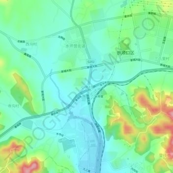
Name: 小南村 topographic map, elevation, terrain.
Location: 小南村, 旅顺口区, 大连市, 辽宁省, 中国 (38.82298 121.22518 38.86298 121.26518)
Average elevation: 40 m
Minimum elevation: -3 m
Maximum elevation: 147 m
Other topographic maps
Click on a map to view its topography, its elevation and its terrain.